Online Help > Placemarks > Measure
How to measure distances and bearings?
To compute distances and bearings between any locations:
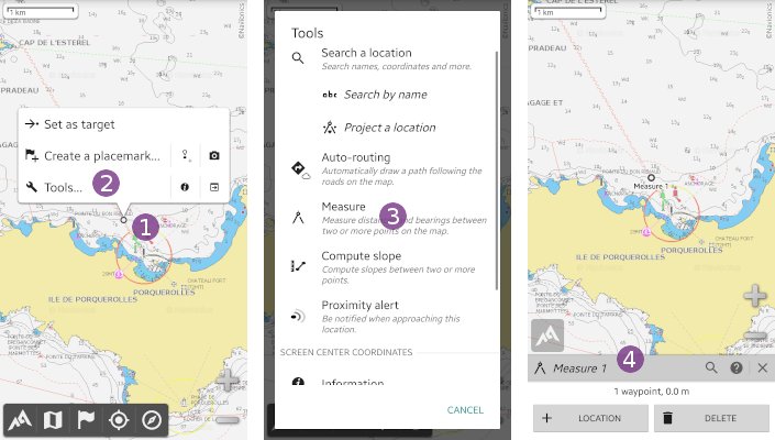
- Move the screen center over the initial location and tap it
 ;
; - Tap on
“Tools…” and on
 “Measure” .
.
The “Measure tool” ![]() side-view is displayed.
side-view is displayed.

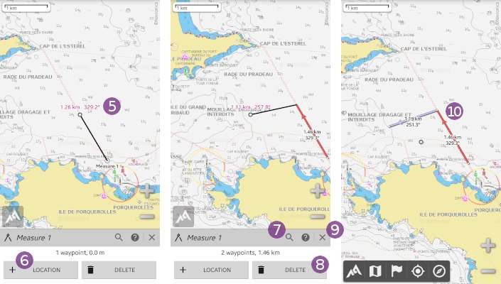
When you move the map center over any other location, the distance and bearing from the initial location to the screen center is previewed ![]() .
.
- Tap
“Location” to set a destination location. You can repeat this process for any number of locations;
 - To move over a particular location using its coordinates, you can use the
“Search” tool;
tool; - If you want to delete the last location, tap
“Delete” ;
; - When you've done, tap on the
“Close” icon to save your measure and close the measure tool.
Your measures remain displayed on the map ![]() until you manually remove them or delete them.
until you manually remove them or delete them.
![]() Lines between measured locations are colored depending on the bearing: red when going north, blue when going south.
Lines between measured locations are colored depending on the bearing: red when going north, blue when going south.

